


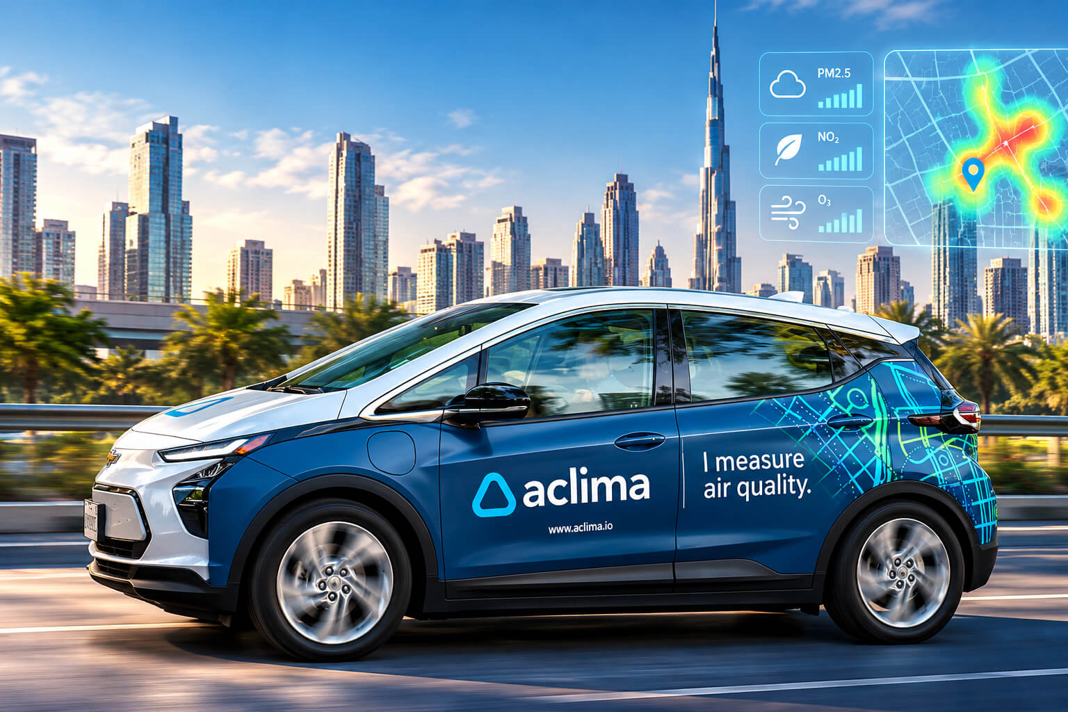
Aclima has been nominated for the 2026 World AI Awards in the Air Quality Monitoring category, recognising its work in turning street-level environmental measurements into detailed maps of how pollution changes from one block to another.
That sounds straightforward until you look at the problem. Traditional regulatory monitoring stations provide essential air-quality information, but there simply aren’t monitors on every street. Pollution can shift sharply over surprisingly short distances because of highways, industrial facilities, freight traffic and other local sources.
Aclima takes the measurement equipment onto the road.
The California Public Benefit Corporation combines mobile sensing, data infrastructure and analytics to measure pollutants at street level. Its technology has been deployed on vehicles travelling through communities, repeatedly sampling the same roads to build a much more granular picture of local pollution.
The World AI Awards recognises organisations, individuals, products and technologies contributing to the development and practical application of artificial intelligence across industries.
Mapping pollution one street at a time
Aclima’s approach starts with mobile measurement.
Vehicles equipped with its sensing technology collect environmental measurements while travelling through streets and neighbourhoods. Location information is attached to those readings, allowing measurements gathered over repeated journeys to become detailed pollution maps.
Its long-running collaboration with Google offers a particularly useful example.
Aclima and Google began working together on air-quality measurement using Street View vehicles in 2015. Four Google Street View cars equipped with Aclima measurement technology subsequently collected high-resolution pollution data across parts of the San Francisco Bay Area, Los Angeles and northern San Joaquin Valley between 2015 and 2019.
The resulting dataset covers pollutants including nitrogen dioxide, nitric oxide, ozone, methane, carbon dioxide, black carbon and ultrafine particles.
Google and Aclima later made more than 42 million hyperlocal air pollution and greenhouse-gas measurements from the California programme available to researchers.
The value isn’t simply the number of readings. It is where they were taken.
Research using the mobile platform demonstrated that pollution can vary persistently within individual city blocks, exposing local hotspots that broader city-level measurements can miss.
California takes mobile monitoring statewide
Aclima’s technology has since moved well beyond early research deployments.
The company is working with the California Air Resources Board (CARB) on the Statewide Mobile Monitoring Initiative, a $27 million programme designed to measure neighbourhood air pollution across communities throughout California.
More than 40 sensor-equipped vehicles are being used for the initiative.
Aclima says the programme covers 64 communities representing approximately 5.2 million residents, with the planned monitoring effort spanning more than 950,000 miles.
There is a community element built into the project as well. Aclima is responsible for working with participating communities to develop Community Air Monitoring Plans, carrying out mobile data collection, analysing the resulting information and producing publicly accessible environmental maps.
That matters because pollution isn’t evenly distributed. A citywide average can describe the broader situation while still saying surprisingly little about what someone is breathing beside a warehouse, freeway or busy intersection.
Where AI and environmental data meet
The scale of mobile monitoring creates another challenge: measurements alone aren’t particularly useful if regulators, researchers and communities cannot turn them into understandable information.
Aclima’s platform combines sensing with data management, quality control, analytics and mapping. Repeated observations can reveal spatial patterns, identify persistent pollution differences and provide datasets that researchers can use for further modelling.
The data has already supported machine-learning research.
Researchers have used Aclima and Google air-quality datasets to investigate relationships between pollution and urban characteristics, while other academic work has examined how mobile measurements can produce stable, high-resolution pollution maps with relatively modest sampling requirements.
This is where the technology becomes more interesting than another environmental sensor.
The objective isn’t simply to detect pollution. It is to understand where concentrations change, how consistently those differences appear and which communities may be experiencing pollution that conventional monitoring networks cannot resolve at street level.
Turning invisible pollution into usable evidence
Aclima’s earlier California work provides a sense of what that looks like at scale.
During one programme with Google Earth Outreach, Aclima reported travelling approximately 100,000 miles over 4,000 hours, gathering more than one billion individual data points across California.
Published scientific research subsequently evaluated the mobile platform across Los Angeles, San Francisco and the northern San Joaquin Valley. Researchers concluded that the approach was effective for quantifying spatial variations in pollutant concentrations over relatively short measurement periods.
That creates practical possibilities for regulators and communities.
Detailed pollution maps can help identify hotspots, investigate potential emission sources, evaluate environmental policies and give residents a clearer picture of conditions around the places where they actually live and work.
Graham Cooke, President of the World AI Awards, said:
“Air pollution is an enormous environmental challenge, but understanding it begins with knowing what is happening at the local level. Aclima’s work demonstrates how advanced sensing, large-scale environmental data and intelligent analytics can make patterns visible that conventional monitoring alone may not capture.
“By mapping air quality street by street, the technology creates opportunities for regulators, researchers and communities to understand pollution with far greater geographic detail. We congratulate Aclima on its 2026 World AI Awards nomination for Air Quality Monitoring and look forward to following the impact of its work.”
Aclima joins organisations, researchers, entrepreneurs and technology developers being recognised through the 2026 World AI Awards.
The programme recognises organisations, individuals and technologies contributing to the development and application of artificial intelligence across industries.
Aclima’s nomination in the Air Quality Monitoring category illustrates a particularly practical side of that shift. AI and advanced analytics don’t have to begin with a chatbot or a general-purpose model. Sometimes the problem is physical, local and largely invisible.
Measure a street often enough, combine those observations with reliable location data, and patterns begin to emerge.
For cities trying to understand who is breathing what — and where — that level of detail can matter.
Learn more about Aclima and its air-quality monitoring technology at aclima.io.
Discover the World AI Awards 2026, explore the nominees and learn more about the awards at worldawards.ai.
